Geography
A.S. - Transfer Degree

Geography
-
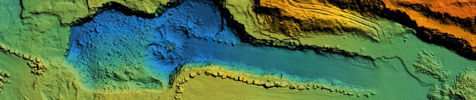
The geospatial science program emphasizes learning about diverse cultures, physical landscapes and geospatial tools. This major offers a diverse program focusing on contemporary local and world issues.
The leverage of knowledge of cultural and physical processes, and digital modeling techniques, to focus on the effects of space and place, and interpret any landscape using an inherently geospatial approach.
Geospatial Science graduates will demonstrate geospatial analysis through mastery of the following skills:
• Formulate a geospatial question, and determine the selection of, and impact on affected stakeholders,
• Describe and explain the relevant physical and human data needed to answer a geospatial question
• Acquire, represent, and process relevant geospatial data,
• Apply analytical models to interpret and explain the patterns, processes, and interrelationships represented by geospatial data, and
• Assess and present results of geospatial analysis.
Program Purpose
Arizona Western College must develop a strategic plan to foster spatial literacy across the geographic curriculum, establish departmental programs to embed geospatial skills, support the K-12 geospatial educational system, and fortify the relationships with the professional workplace environments. Infusing geospatial technologies and spatial literacy can have long-term impacts on the individual, institutions, and society.
Learning Outcomes
- Analyze the controls, distribution, and classification of world climates.
- Compare and contrast different types of landforms.
- Analyze spatially related problems related to current/recent geo-political events.
- Use spatial thinking to analyze the human organization of space.
- Understand the associations and networks among phenomena in particular places.
- Recognize and interpret the relationships among patterns and processes at different scales of analysis.
Program Map
Recommended Program Map / Program Requirements
This program map has been updated for new students starting in Fall 2025 (or after) to reflect the new Arizona General Education Curriculum (AGEC) requirements. Students following previous catalogs can find corresponding program maps in Self-Service/Student Planning. For official requirements, refer to the AWC Catalog.
The recommended plan below meets all program requirements. If the classes listed as recommended don’t align with your schedule or interests, alternative options are available. Visit Academic Planning to get started on your personalized Academic Plan or schedule an appointment with your Faculty Advisor or the Advisement Services Office.
Program Requirements Based on Fall/Spring rotation (AGEC certificate also included)
First Semester
| Course | Course Title | Credits | Area |
|---|---|---|---|
| GEO 102 | Introduction to Human Geography | 3 | Major Requirement |
| MAT 187 |
Precalculus/GE (recommended) |
5 | GE-Quantitative Reasoning |
| ENG 101 or ENG 107 |
Freshman Composition I/GE | 3 | GE-Written Communication |
| ART/HUM | Choose one course from Arts & Humanities | 3 | GE-Arts & Humanities |
| SOC/BEH | Choose one course from Social & Behavioral Sciences | 3 | GE-Social & Behavioral Sciences |
| 17 |
Milestones:
- Meet professors one-on-one
- Research University Degree Program options
- Plan with your advisor after midterm grades posted
Co-Curricular Requirements:
- Attend AWC Majors Fair & Career Expos
- Register with Jobs 4 Matadors
Second Semester
| Course | Course Title | Credits | Area |
|---|---|---|---|
| GEO 105 | World Regional Geography | 3 | Major Requirement |
| GPH 110 | Introduction to Physical Geography | 4 | Major Requirement |
| ENG 102 or ENG 108 |
Freshman Composition II/GE | 3 | GE-Written Communication |
| CHM 151 | General Chemistry I/GE (recommended) | 4 | GE-Natural Sciences |
| 16 |
Milestones:
- Join a club
Co-Curricular Requirements:
- Attend Transfer Services Events
- Apply for Scholarships
Third Semester
| Course | Course Title | Credits | Area |
|---|---|---|---|
| GST 101 | Introduction to Geospatial Technology | 2 | Major Requirement |
| GPH 171 or GPH 213 |
Introduction to Meteorology or Introduction to Climate Science |
4 | Departmental Requirement |
| ART/HUM | Choose one course from Arts & Humanities | 3 | GE-Arts & Humanities |
| SOC/BEH | Choose one course from Social & Behavioral Sciences | 3 | GE-Social & Behavioral Sciences |
| 12 |
Milestones:
- If transferring, apply to universities
Co-Curricular Requirements:
- Visit universities campus
- Apply for internship or volunteer opportunities
Fourth Semester
| Course | Course Title | Credits | Area |
|---|---|---|---|
| DEPT REQ | Choose additional courses from Geography, Geospatial Sciences, Physics, Chemistry, or Geology | 10 | Departmental Requirement |
| ORAL COMM | Choose one course from Oral Communication | 3-4 | GE-Oral Communication |
| INST/AME | Choose one course from Institutions in the Americas | 3 | GE-Institutions in the Americas |
| 16-17 |
Milestones:
- Apply for Graduation
Co-Curricular Requirements:
- Attend Etiquette Lunch
- Meet with Career Services
- Apply for university scholarship opportunities